Venue, Flights & Map
IOL 2024 will be held in the city of Brasilia, the political capital of Brazil. The city is famously projected from scratch as a modernist urban planning masterpiece, taking the shape of an airplane and later growing organically around it.
Arrivals and departures
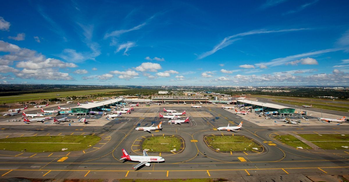
The Delegations will mostly arrive through Brasilia International Airport, President Juscelino Kubitschek (IATA: BSB), located by the end of the city's Southern Wing.
The airport receives direct commercial flights from a number of countries, but it is also possible that your arrival to Brazil will be through the busier airports of São Paulo - Guarulhos (Governador André Franco Montoro, GRU) or Rio de Janeiro - Galeão (Antônio Carlos Jobim, GIG). In these scenarios, it can be convenient to check separately the international leg of your flight and the Brazilian domestic one.
The main air companies operating in Brazil are LATAM, Gol, and Azul. They also operate international flights, either directly or in partnership with other international companies.
Activities
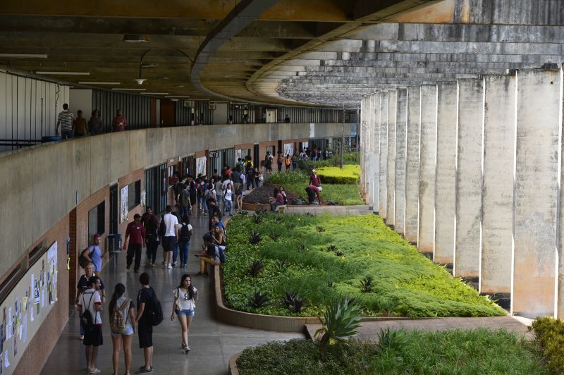
Most of the activities, including ceremonies and competitions, will happen in the central campus of Universidade de Brasília (UnB) one of the main universities in Brazil, located at the frontline of the city's Northern Wing.
There, ceremonies will happen in the Auditory of the Docent's Association (ADUnB), while many activities will happen in classroom buildings and some of the meals will be in the University Restaurant.
Accommodation
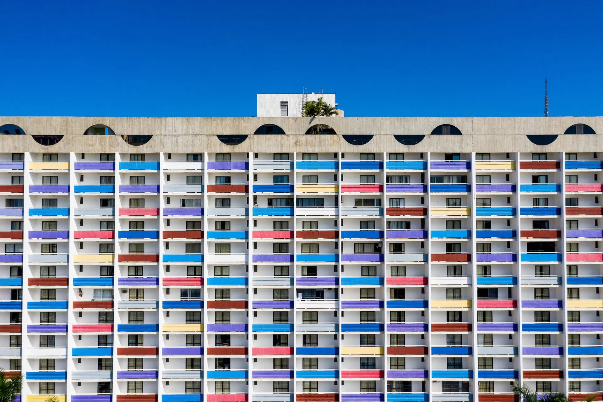
The Delegations, Jury and Staff will be accommodated at the St. Paul Plaza Hotel, located in the Southern Hotel's Sector, along the Main Axis of Brasilia's airplane. Participants will be mostly accommodated in double or triple rooms.
The hotels counts with a swimming pool and other playing amenities, and it is very close to a number of shopping malls, as well as to the Burle Marx Gardens.
Brasília
Brasília, located at the heart of Brazil's Central Plateau, is also the political heart of the country. With around 4,6 million inhabitants and being the fourth-biggest metropolitan area, it can be considered a medium-sized city in Brazilian standards – behind the areas of São Paulo (20 mi), Rio (10 mi) and Belo Horizonte (6 mi), and followed closely by Porto Alegre, Fortaleza, Recife and Salvador. Founded in 1960, it is a young city, but its population already shows distinct linguistic traits that compose the Brasiliense dialect of Brazilian Portuguese.
How it came to be?
With the exception of Belo Horizonte, Brasilia is the only of the cities mentioned above that lies more than 150 km from the Atlantic Ocean, and this is no accident. Brazil as a political entity was developed as a commercial colony of the Portuguese Ultramarine Empire, as a part of the triangular trade route involving the Caribbean, West Africa and Europe. As such, the Brazilian population was always more concentrated by the seashore (Belo Horizonte, as an exception, arose as part of the historical context of gold and diamond extraction).
Thus, Brasilia was planned as part of a plan to populate the central and western areas of Brazil with a new and planned city. True, it was not the first of such efforts (Belo Horizonte in 1897 and Goiânia in 1933 were also founded as planned cities designed from scratch) but this one was some steps further.
For one, it was meant not for a state capital but for the capital of the whole country, taking all the administrative and decisory power from the already overcrowded Rio de Janeiro (and, as some critics said, taking away the power places from the mobilizing population). Further, it was planned in the 1950s as a jewel of the developmentalist policymaking of president Juscelino Kubitschek (otherwise know for an accelerated industrialisation of Brazil) and of the modernist architecture, from the hands of the iconic architect Oscar Niemeyer and the urban planner Lúcio Costa.
But much beyond these three men, the city was built by an enormous contingent of migrant workforce, entire families coming from the whole country but especially from the North and Northeastern Regions. These candangos (a term possibly coming from Kimbundu language that became a gentilic for the brasilienses) built the city during four years, until its inauguration in 1960 and beyond. Ironically, the city was not planned to include its builders, so they also became the first peripheral population of the city, gathering in unplanned settlements around the formal Pilot Plan.
Furthermore, different elected politicians, public bureaucrats and providers of support services came, and the original plan, made to support 500.000 inhabitants, became quickly insufficient. Today, the almost 5 million inhabitants of Brasilia's metropolitan area distribute themselves in a complex and multifaceted urban fabric – still having in its center the Pilot Plan, as a monument to the human dream of controlling the space through rationality, and failing to do it.
How it is drawn?
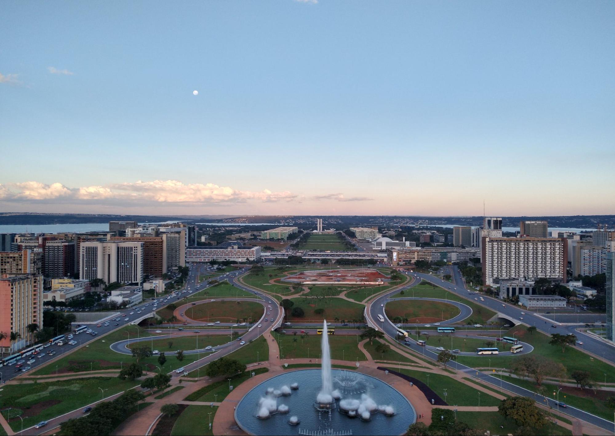
Brasilia's Pilot Plan has two main road axis.
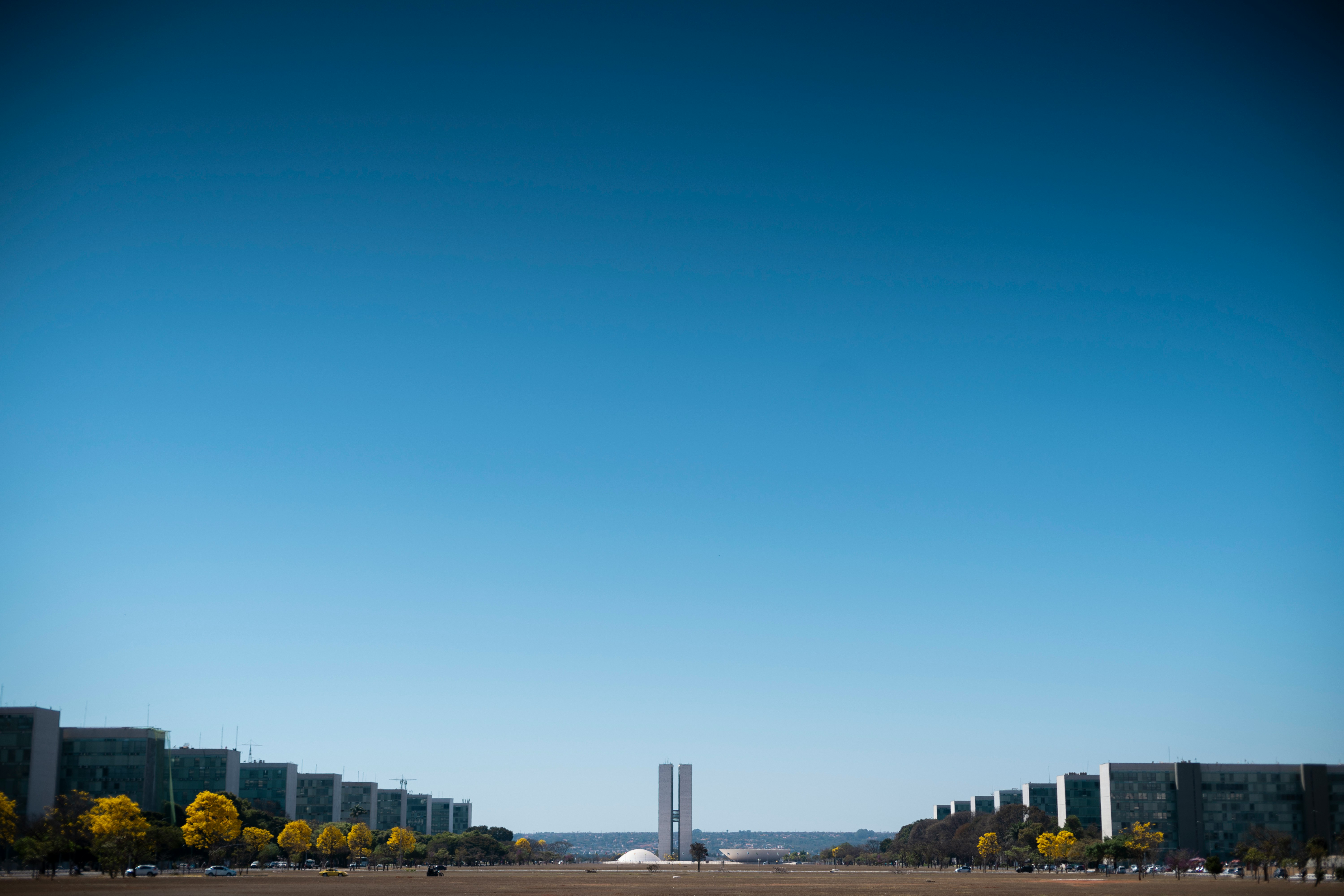
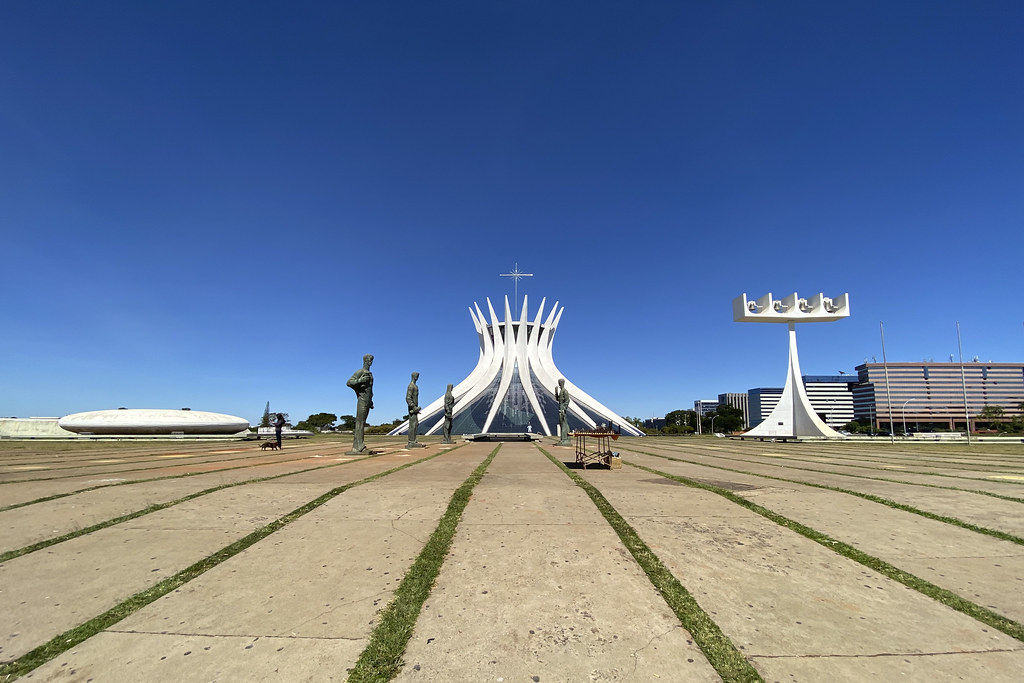
The first, shorter and straight, is the Monumental Axis, representing the body of the airplane. Its tail touches the BR-450, the main highway that connects the city to the outer highways, while its body includes some very iconic towers, museums, memorials and the Brasilia Cathedral, and towards the head come the Esplanade of the Ministries, aligned right and left to the axis, ending in the Plaza of the Three Powers, bordered by the three centers of power of the republic: the National Congress (legislative), the Planalto Presidential Palace (executive) and the Supreme Federal Court (judiciary).
The second, longer and curved, is the Rodoviary Axis, or Big Axis (pt. Eixão), making the wings of the airplane. The metro of Brasília runs under the Eixão (although the North Wing continuation was not inaugurated yet). Other long avenues run parallel to the Eixão, to the West (called W1, W2 etc, up to W7) and to the East (L1 to L4).
The urbanism is more or less mirrored between South and North Wings and it consists in SuperSquares (SuperQuadras, or SQ) within this grid. Each SQ is a cell containing residential buildings, green areas and, some of then, a small street with local commerce.
Addresses in the Pilot Plan are thus very systematic. Every SQ has a number, growing in unities going longitudinally south (S 1, 2, 3… 14) and north (N 1, 2, 3 … 14) from the Monumental Axis, and growing in the hundreds transversally, even numbers to the west and odd numbers to the east. Thus, the vegetarian restaurant The Plant is located in the Local Commerce South 103 (CLS 103) adjacent to the SQS 103 in the South Wing, while the japanese restaurant Katsu Lamen have the address CLN 411, store 39, being in the North Wing, quite close to the University.
Where it lies?
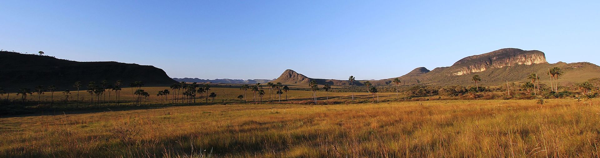
Brasilia lies in the so-called Central Plateau, the central part of the Brazilian Plateau, comprising a good part of the innerlands of Brazil. It is a huge, mostly flat or hilly, region, between 300 and 900 m of altitude, geologically very old.
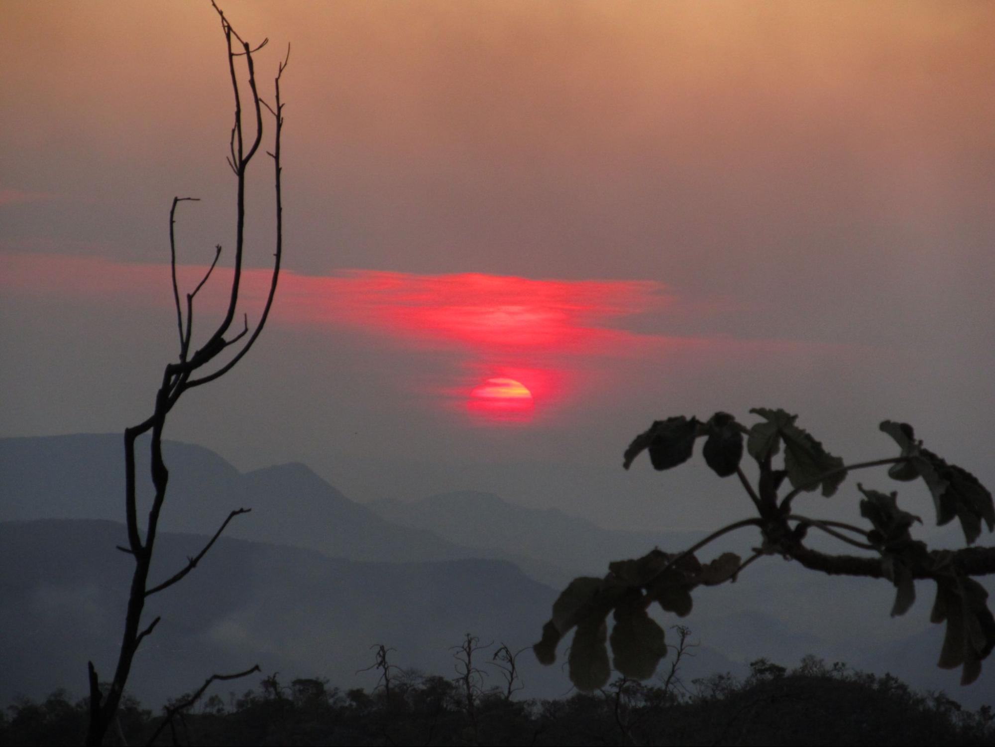
The Central Plateau is covered by a biome called Cerrado, which is a biome of savanna type: one in which woodlands and grasslands combine, with forests of smaller trees and open canopy. The cerrado is hot and dry, with a wetter season in the southern summer (20-25°C, 60-70% hum.) and a dryer season in the southern winter (15-20°C, 30-40% hum.) – the latter being the period when IOL 2024 will be held.

In fact, the Cerrado is the second-biggest biome of Brazil, surrounded by the Amazon and the Atlantic Tropical Forests to the north and southeast respectively. In the dry season, from May to September, the landscape gains a distinctly yellowish tone covered by a vast light-blue sky, and its small, curled bush-like woodlands are often cleared by Natural Fires (and also criminal fires). This is also the season where you should walk with a water bottle at all times.
The wet season, meanwhile, sees the strongest passage of the Flying Rivers, the water that comes from the Atlantic, thickens with the transpiration of the Amazon in a westward air current, is deflected by the Andes and comes to fertilize the Central-South parts of Brazil. This name, flying rivers, is a name born from recent climatological models, due to the fact that the amount of water carried by this phenomenon sums up to 4 times the waterflow of the Amazon river, in itself the biggest river in the world in water volume.
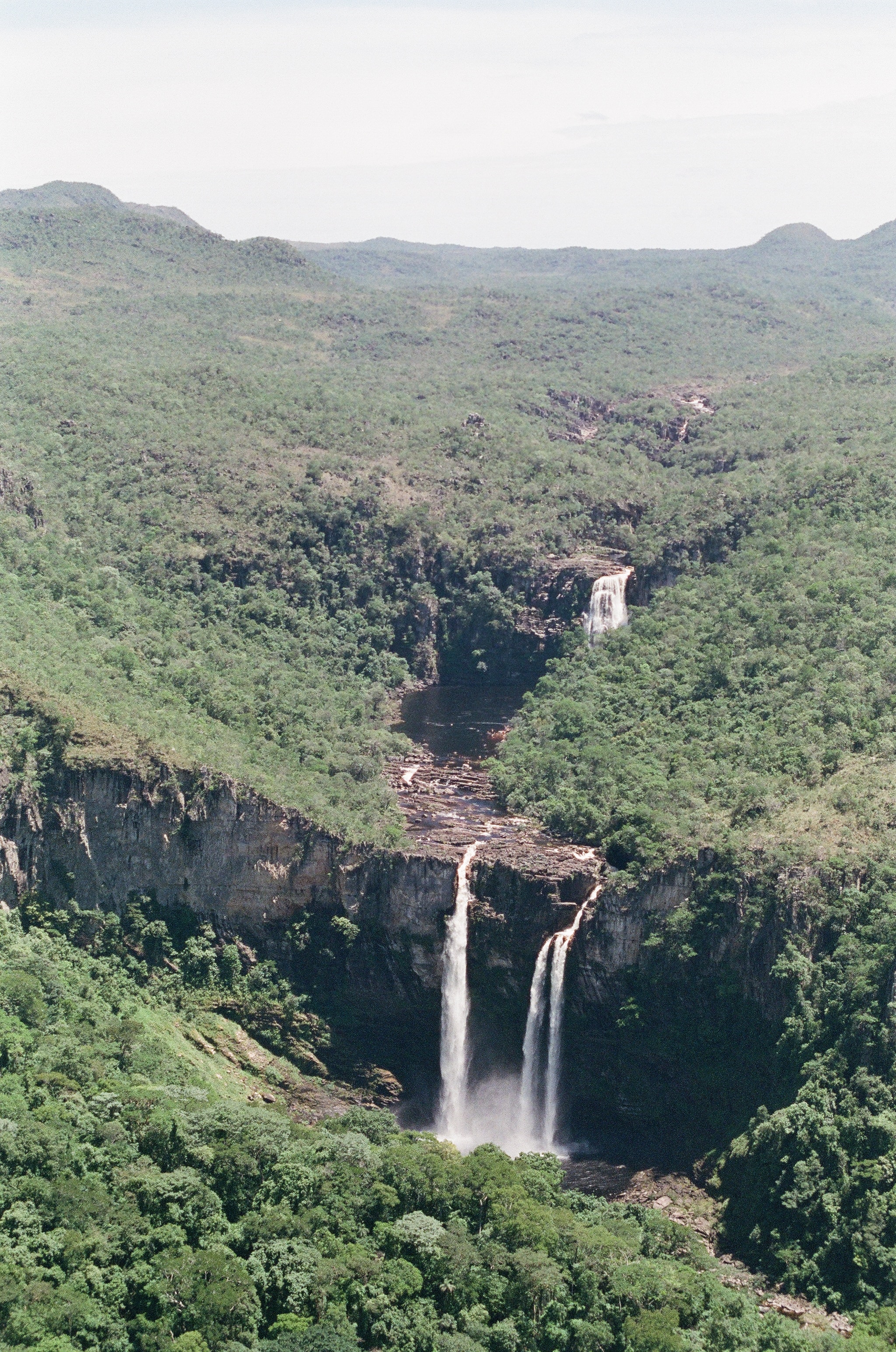
The Cerrado is extremely rich in vegetal and animal species, and the Central Plateau enriches it further with tall landscapes, waterfalls and very beautiful places. Unfortunately, it is also a strongly threatened biome in Brazil, being depleted by large export-oriented plantations of grains such as soy, corn and wheat. Already in 1961, the president Juscelino Kubitschek, after founding Brasília, also founded the Chapada dos Veadeiros National Park, a 65 000 hectares conservation area some 150 km north of the capital. The Park stands nowadays as one of the main tourist attractions in the whole Central Plateau.
City tour
For the afternoon of the city tour we chose three main points to be visited, two in the open and one in closed space -- the last one has to be chosen among three options.
All groups will descend by bus the Monumental Axis, especially around the Esplanda of the Ministries, and will stop at the Plaza of the Three Powers (Praça dos Três Poderes), the political center of Brazil. This rectangular plaza has, in its three sides, the iconic main buildings of the three powers: the Planalto Palace (which hosts the Preisident and the Executive Power), the National Congress (which hosts the deputies and senators, the Legislative Power) and the Supreme Court (the Judiciary Power). The fourth side is bordered by a park of cerrado trees. The plaza also contains some iconic monuments and a small memorial of the city.
Groups will also go up in the old TV Tower, further west in the Monumental Axis. From up there, it is possible to see the entire Pilot Plan and the horizons around the city of Brasília.
For the closed space, there will be three options:
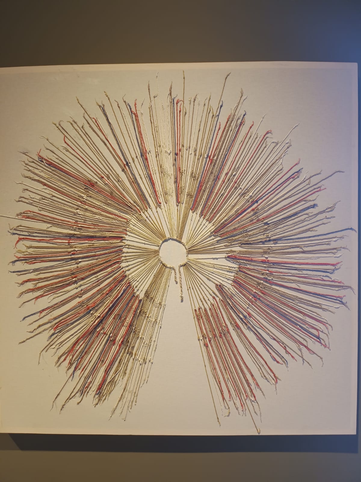
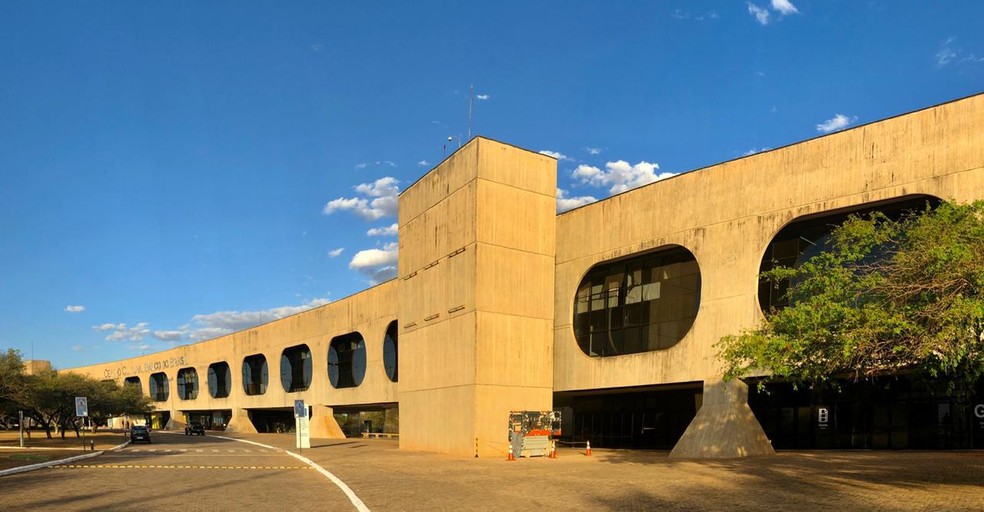
- Centro Cultural Banco do Brasil (CCBB), a modernist exhibition hall which will have two exihibitions: "Ancient Treasures of Peru", which shows metalworks, ceramics and threadwork from old Andine cultures, including the Inca Empire; and "Hiromi Nagakura to the Amazon with Ailton Krenak", which shows beautiful pictures of Amazonian indigenous people made by the Japanese photograph in his travels with the famous indigenous leader Ailton Krenak.

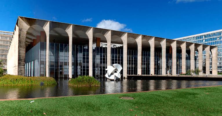
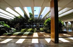
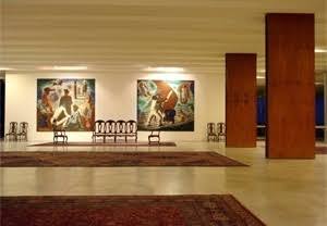
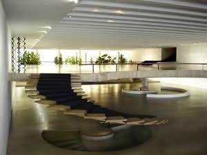
- Palácio do Itamaraty, the palace of the Ministry of External Affairs, one of the jewels of the Esplanada of the Ministries, combines the modernist architecture with classic mobiliary and beautiful inner gardens, it showcases the corridors of the diplomacy in the world, its ceremonies, negotiations and reception.
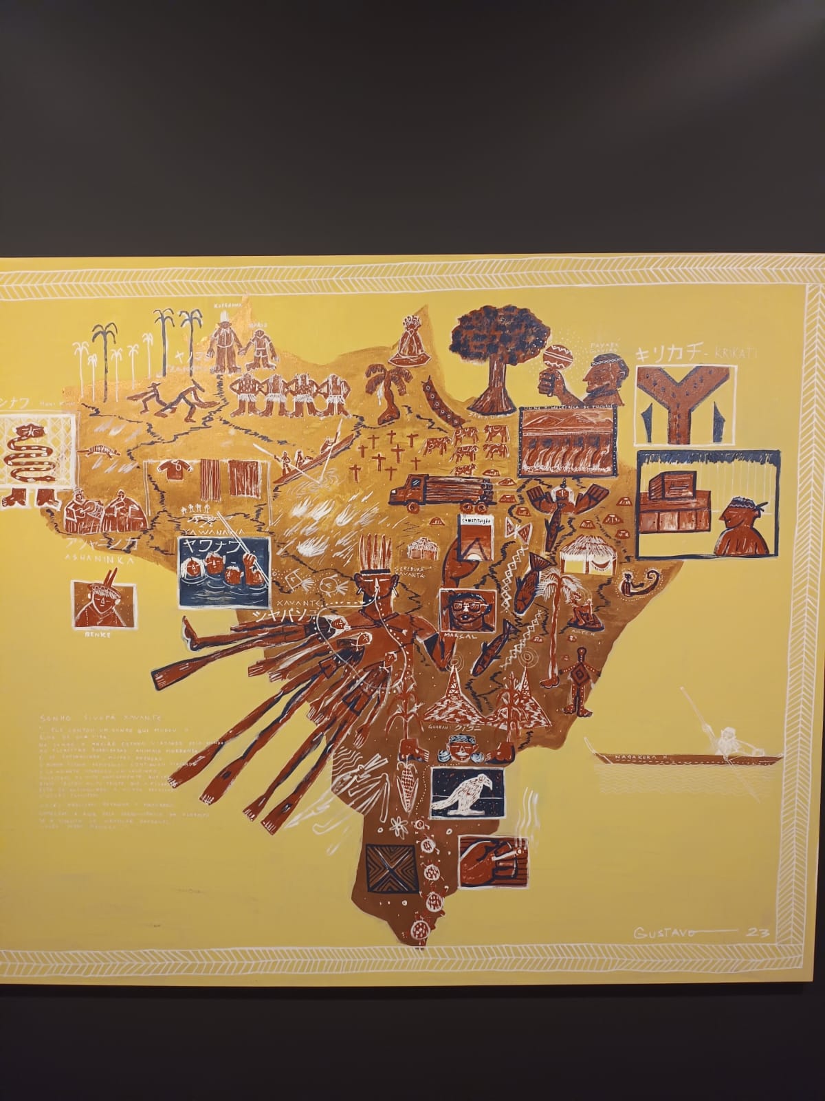
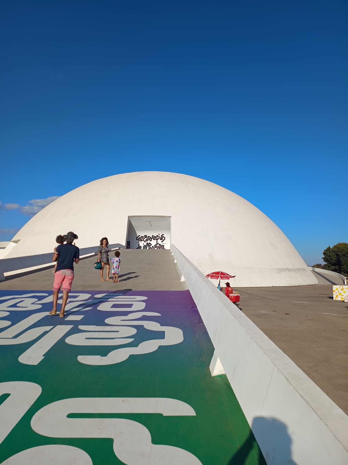
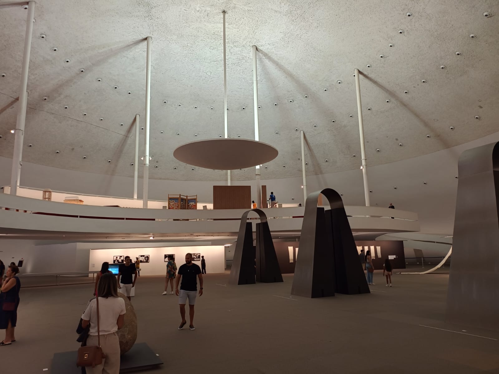
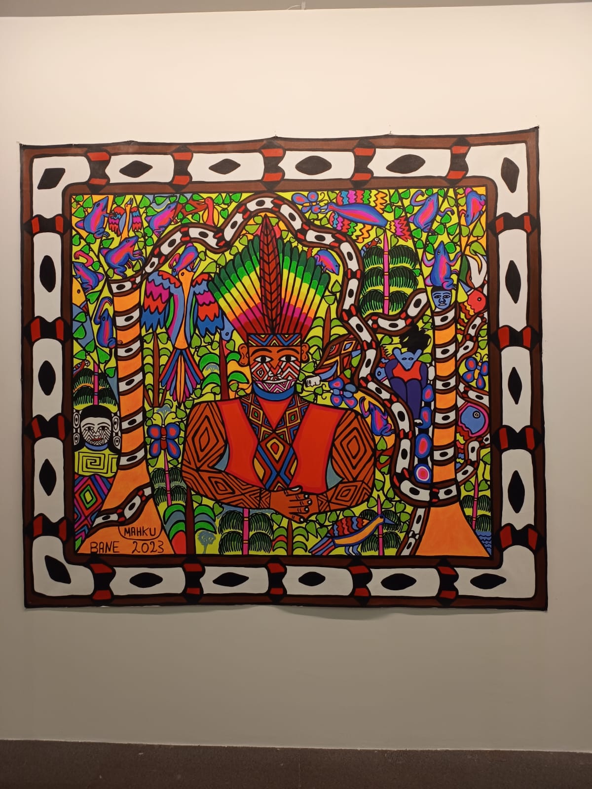
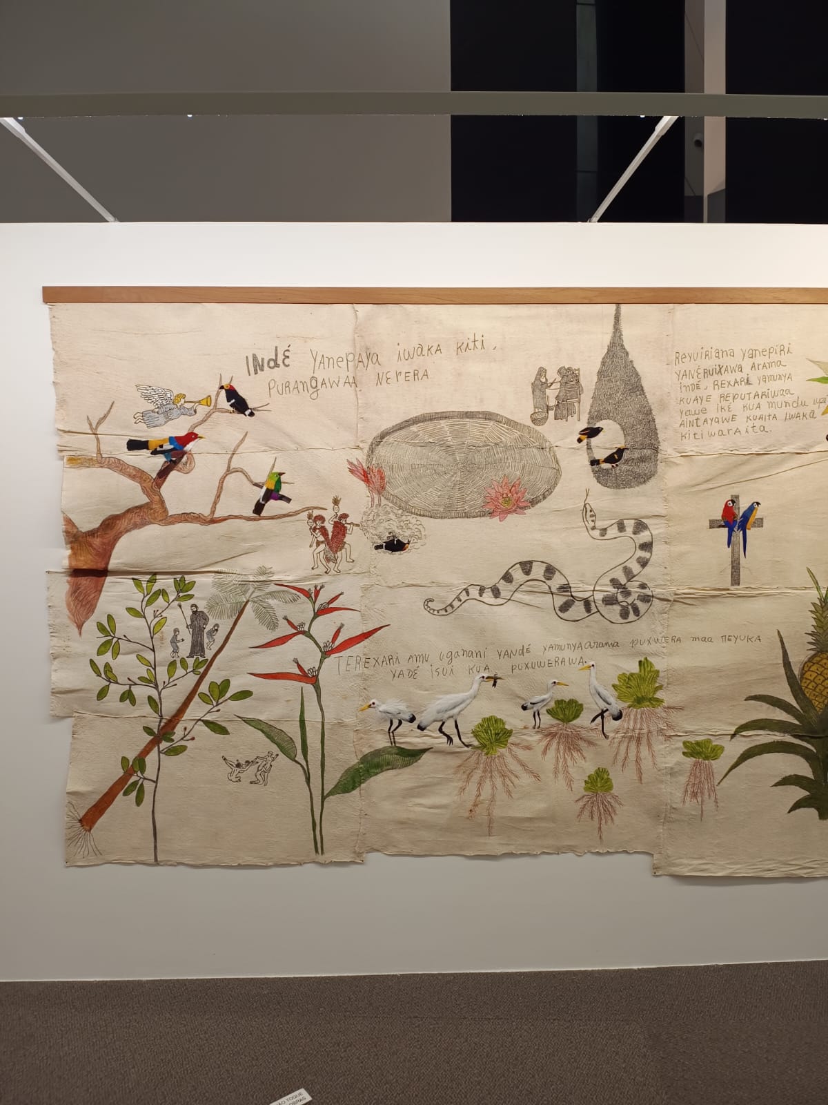
- Brasilia Cathedral + National Museum, two neighbor buildings in the Esplanada. The Cathedral is one of the symbols of the city, while the National Museum, drawn by Oscar Niemeyer, will feature also two exhibitions: selected works from São Paulo Bienal 2023, including contemporary indigenous and afroamerican artists, and the expo from "Festival Latinidades", showing the latin-american woman from different perspectives.
Please remember that spots are limited for each of the three options. Please fill in this form to register your preference until July 16.